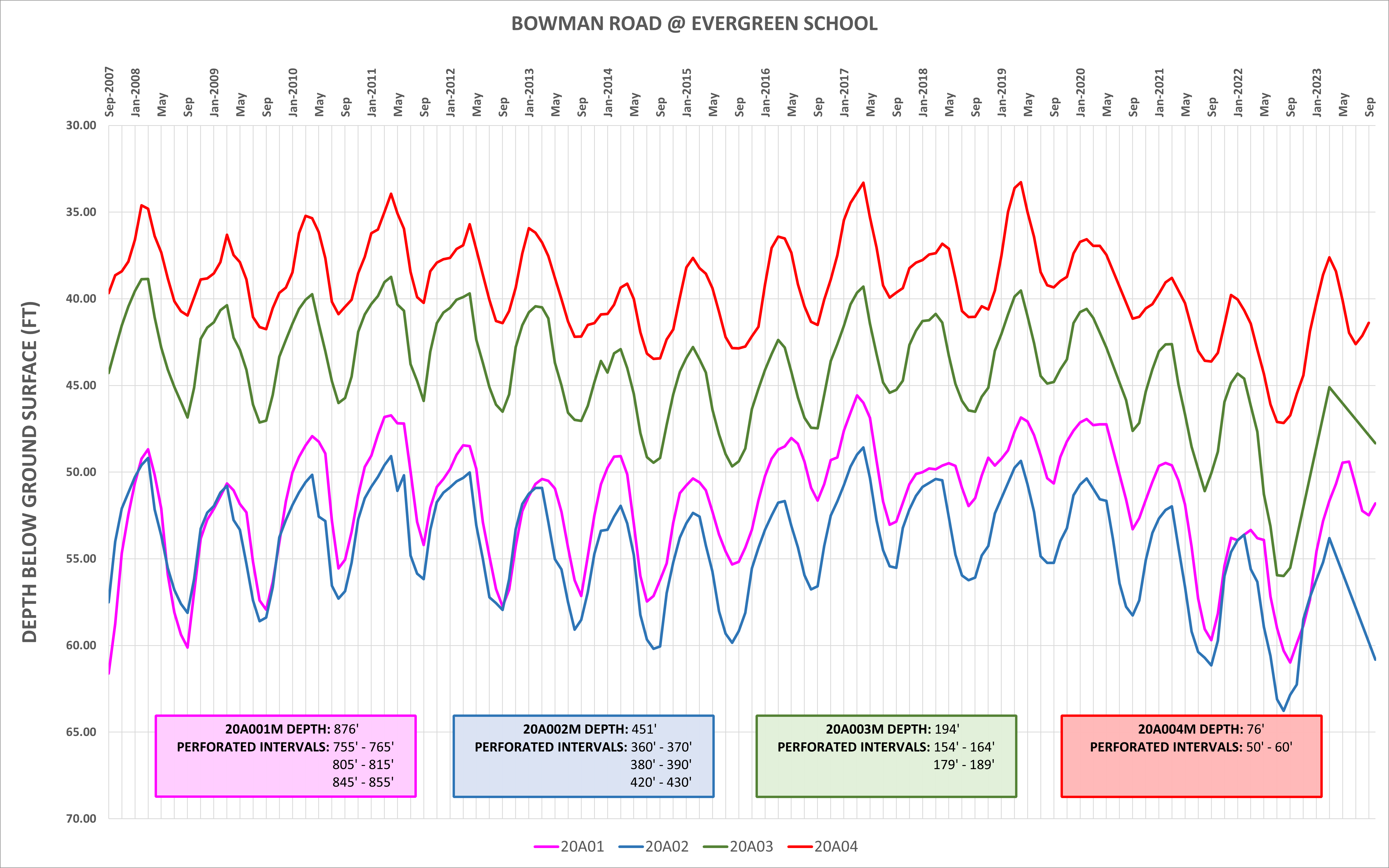
Groundwater Level Monitoring
Hydrographs
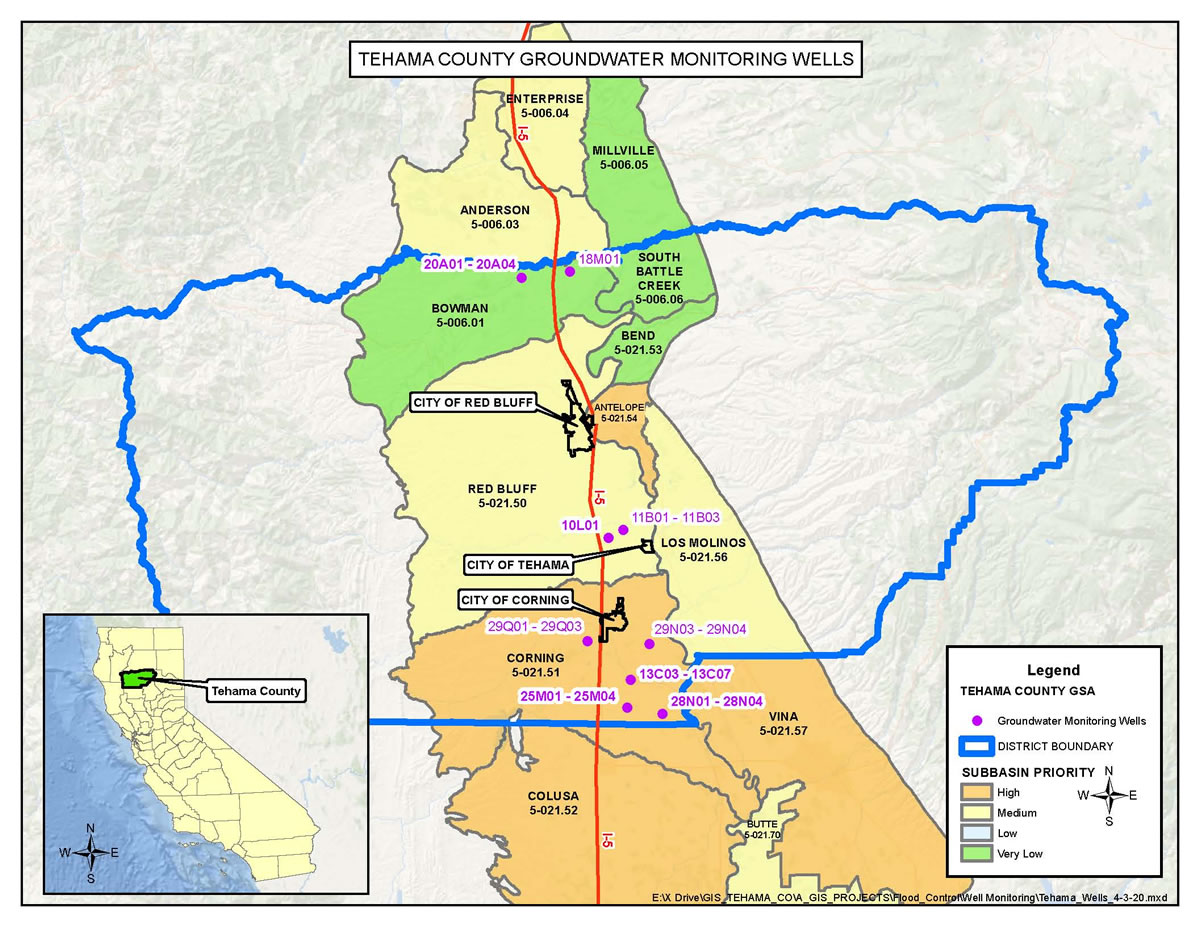
Gerber Road
East of Hwy. 99W
25N03W11B01M – 25N03W11B03M
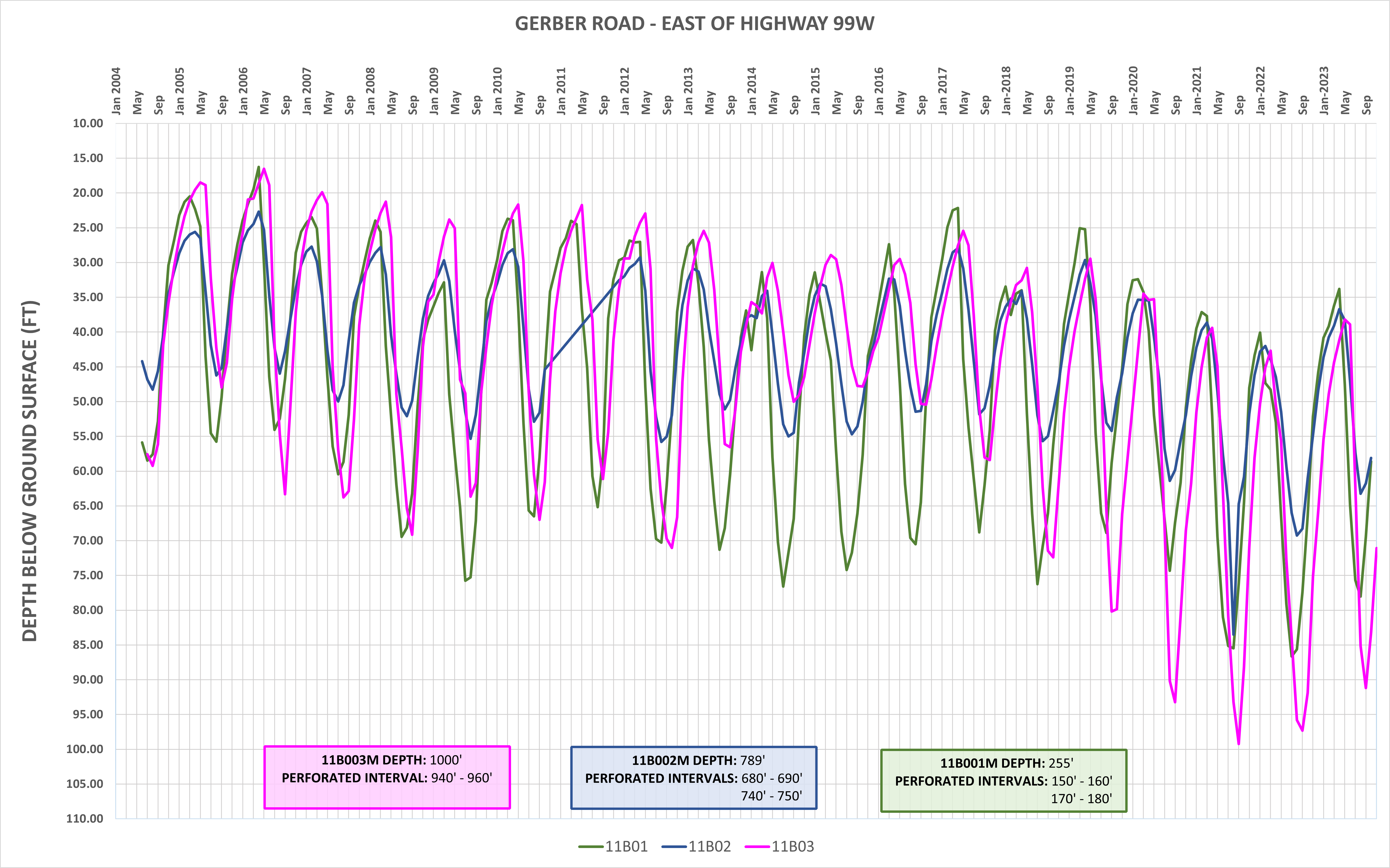
Capay Road
@ Hall Road
23N03W13C03M – 23N03W13C07M
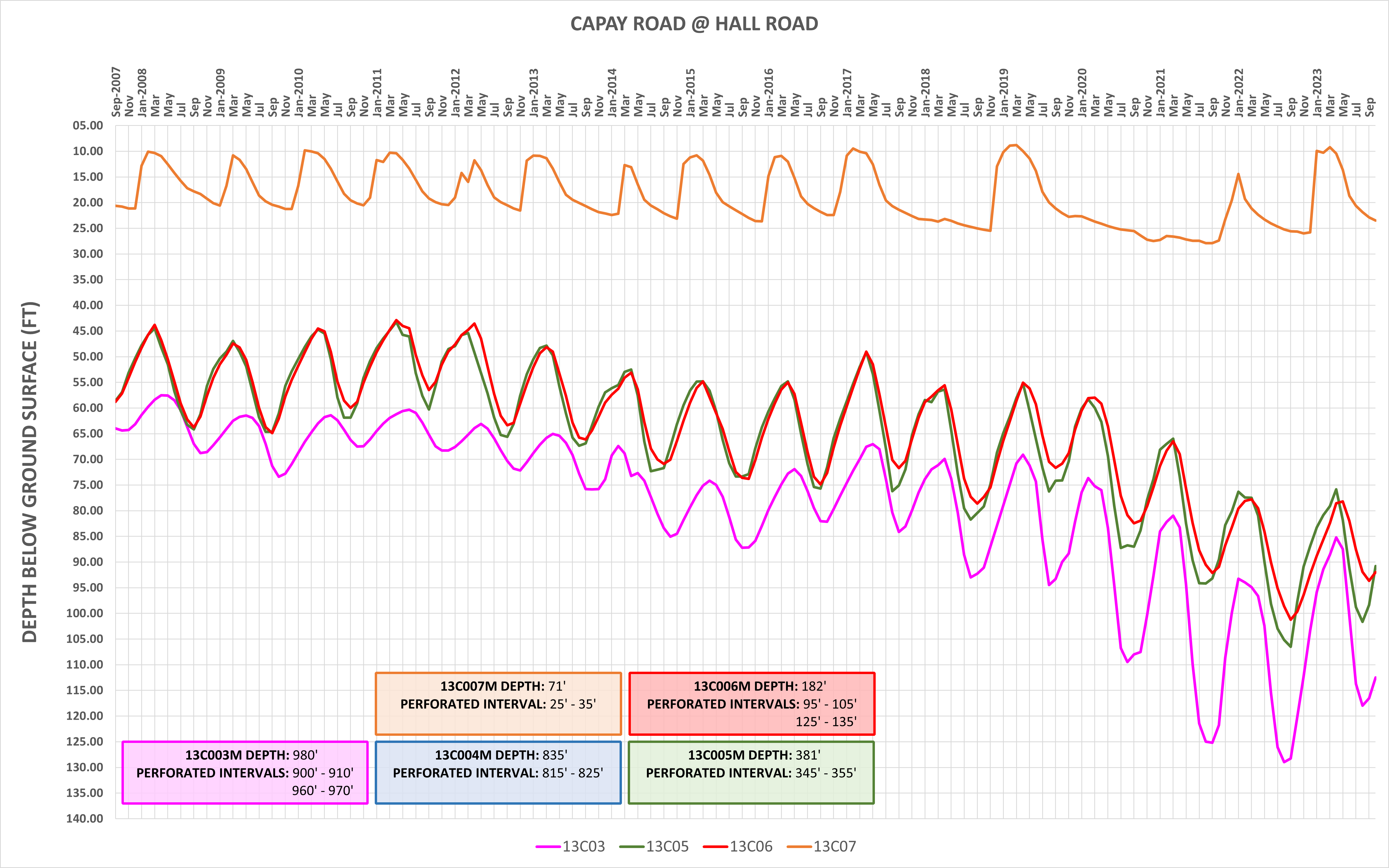
Bowman Road
@ Evergreen School
29N04W20A01M – 29N04W20A04M
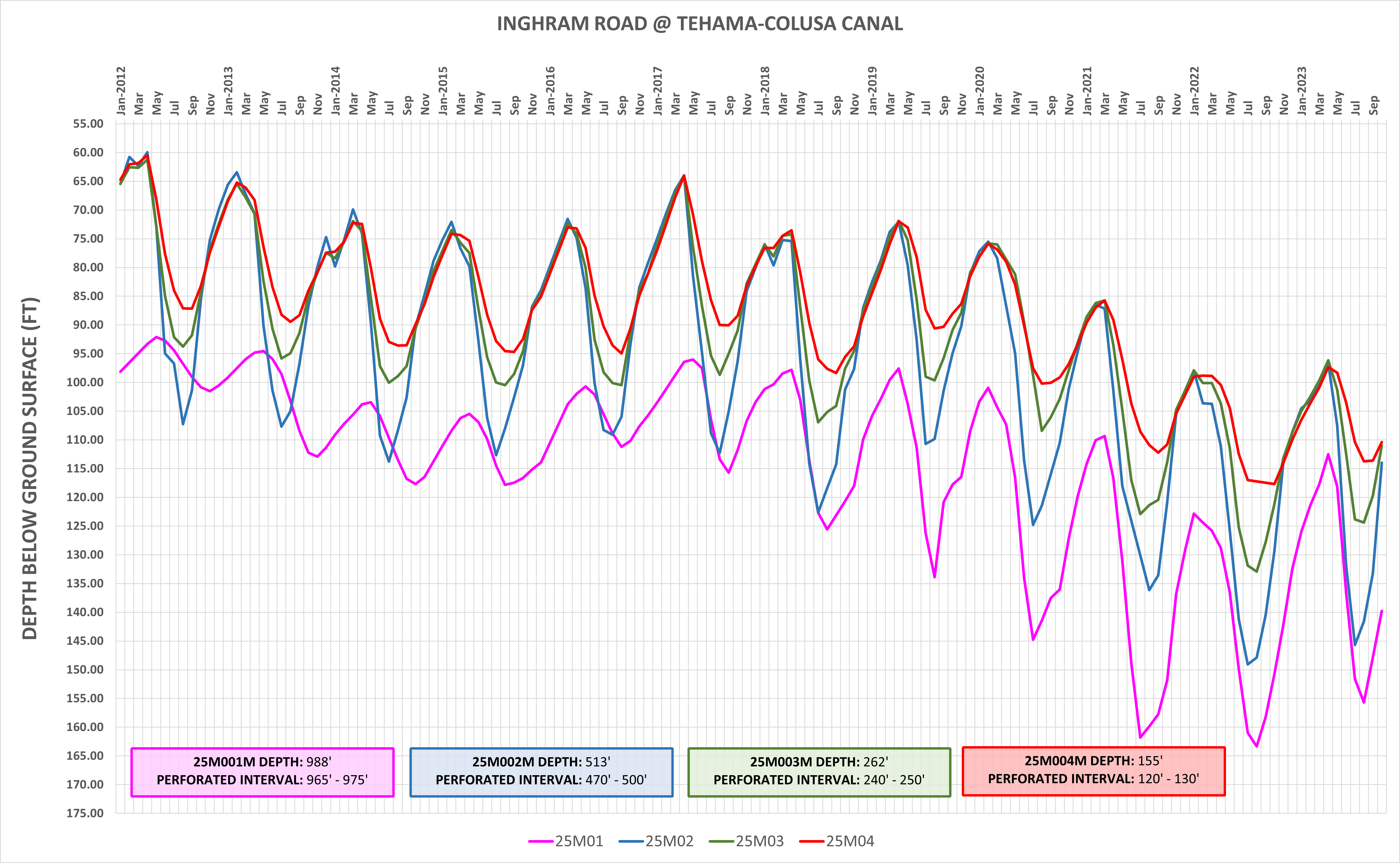
Inghram Road
@ Tehama-Colusa Canal
23N03W25M01M – 23N03W25M04M
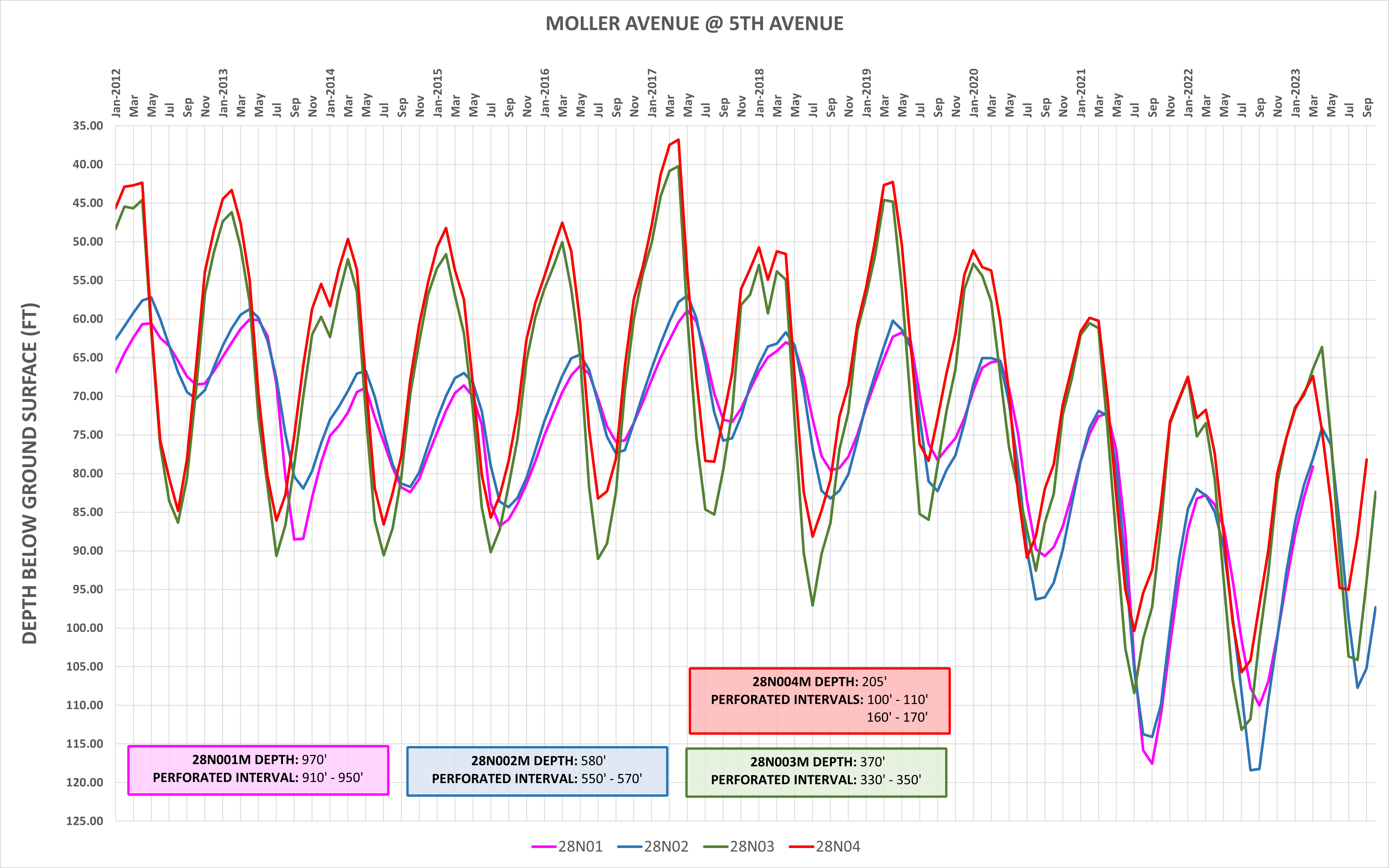
Moller Avenue
@ 5th Avenue
23N02W28N01M – 23N02W28N04M
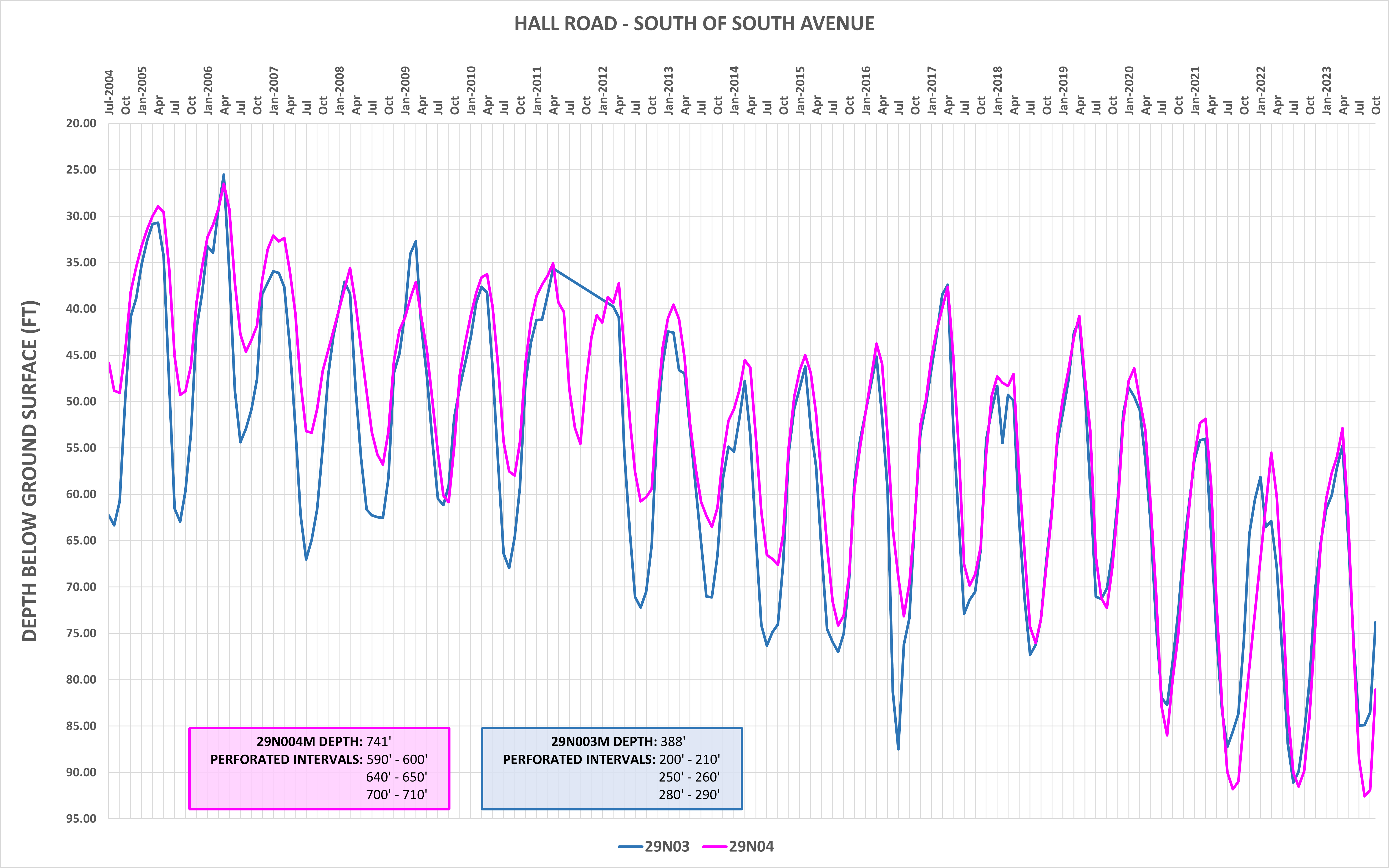
Hall Road
South of South Avenue
24N02W29N03M – 24N02W29N04M
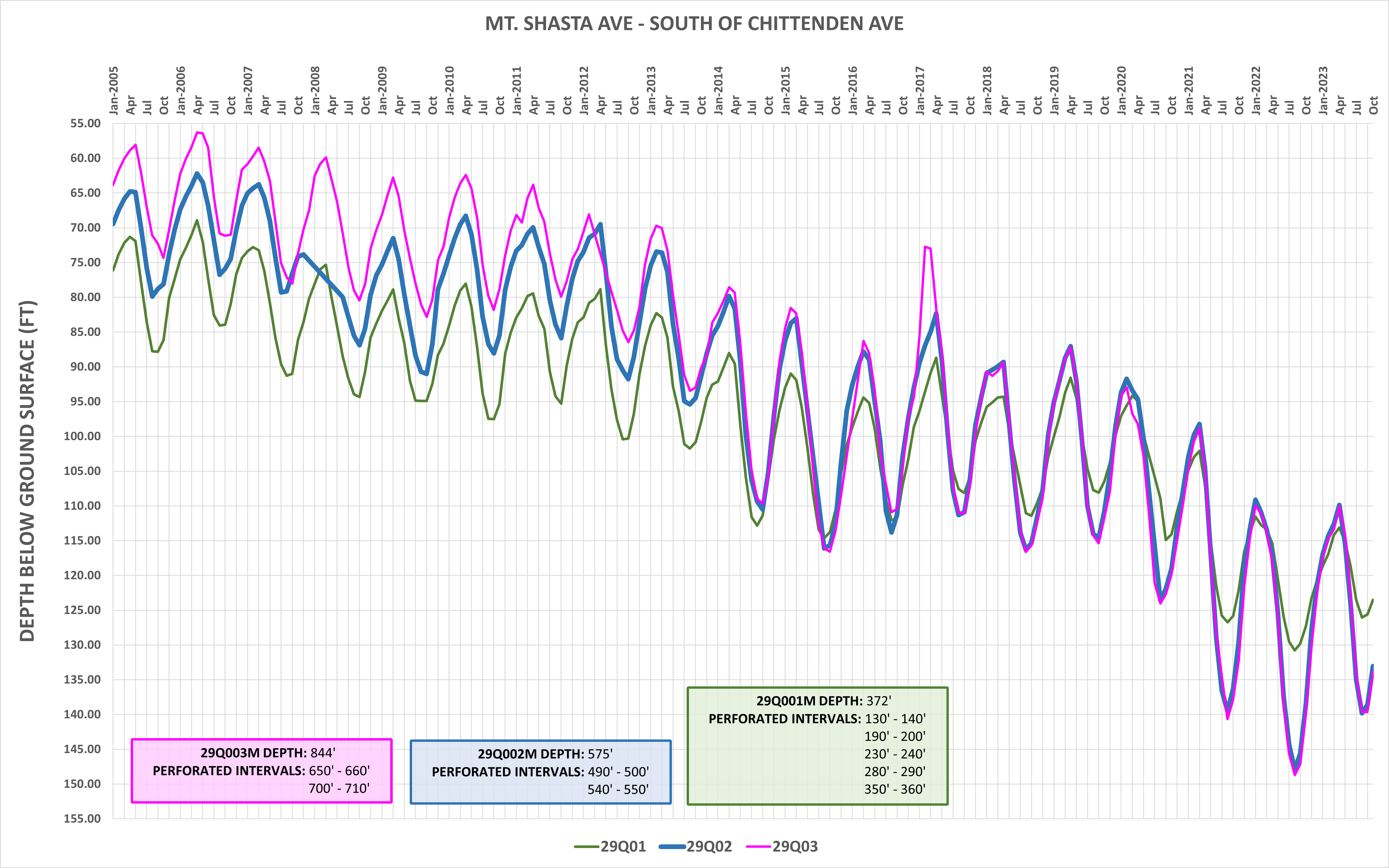
Mt. Shasta Avenue
South of Chittenden Road
24N03W29Q01M – 24N03W29Q03M
California Statewide Groundwater Elevation Monitoring (CASGEM)
On November 4, 2009 the State Legislature amended the Water Code with SBx7-6, which mandates a statewide groundwater elevation monitoring program to track seasonal and long-term trends in groundwater elevations in California's groundwater basins. To achieve that goal, the amendment requires collaboration between local monitoring entities and Department of Water Resources (DWR) to collect groundwater elevation data. Collection and evaluation of such data on a statewide scale is an important fundamental step toward improving management of California's groundwater resources.
In accordance with this amendment to the Water Code, DWR developed the California Statewide Groundwater Elevation Monitoring (CASGEM) program. The intent of the CASGEM program is to establish a permanent, locally-managed program of regular and systematic monitoring in all of California's alluvial groundwater basins. The CASGEM program will rely and build on the many, established local long-term groundwater monitoring and management programs. DWR's role is to coordinate the CASGEM program, to work cooperatively with local entities, and to maintain the collected elevation data in a readily and widely available public database. DWR will also continue its current network of groundwater monitoring as funding allows.
The County of Tehama is participating as a monitoring entity for the CASGEM program.