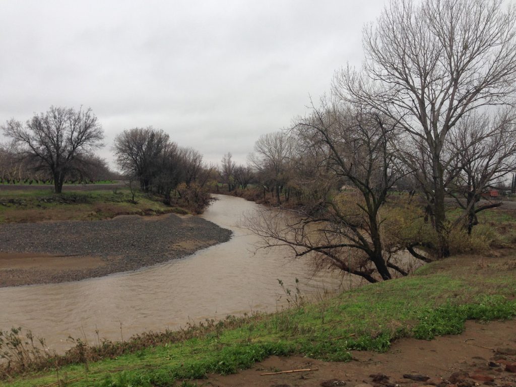
Elder Creek in Tehama County

Flood Control

County Maintained Levee Systems

The Deer Creek levee system near Vina and the Elder Creek levee system near Gerber, with system and evacuation maps, the District’s private levee policy and flood fight resources.

Flood Emergency?

In case of emergency, call 911.

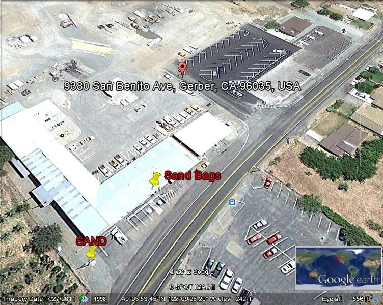
Non-emergency contacts, sandbag locations and flood safety tips:

Near Vina

Deer Creek Levee System

The Deer Creek levee system includes 4 systems near Vina, CA that flow into the Sacramento River. The levee systems were primarily constructed by locals for the purpose of flood control beginning in the late 1940s.

In addition to the channel improvement work performed for approximately 5.4 miles of the existing levees by the US Army Corps of Engineers (USACE), new levees were constructed during the 1958 improvements.

At a glance

4 levee systems

Near Vina, CA

Flows into the Sacramento River

Built from the late 1940s

~5.4 miles of USACE channel work

1958 improvements

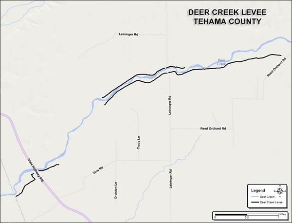
Map of the Deer Creek levee system near Vina

Deer Creek

Levee System Map

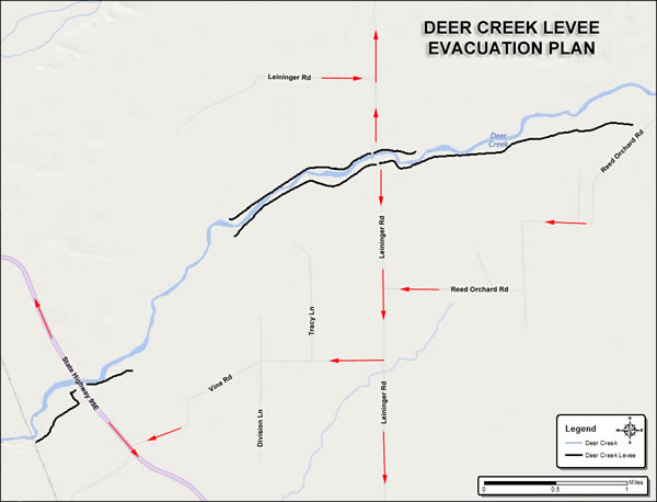
Deer Creek levee evacuation plan map showing evacuation routes along Leininger Rd, Reed Orchard Rd and Vina Rd

Deer Creek

Levee Evacuation Map

Near Gerber

Elder Creek Levee System

The Elder Creek levee systems are a portion of the Sacramento River and Major and Minor Tributaries Project. The Sacramento River and Major and Minor Tributaries Project is comprised of levees, weirs, pumping stations, and bypass channels on the Sacramento River and associated tributaries.

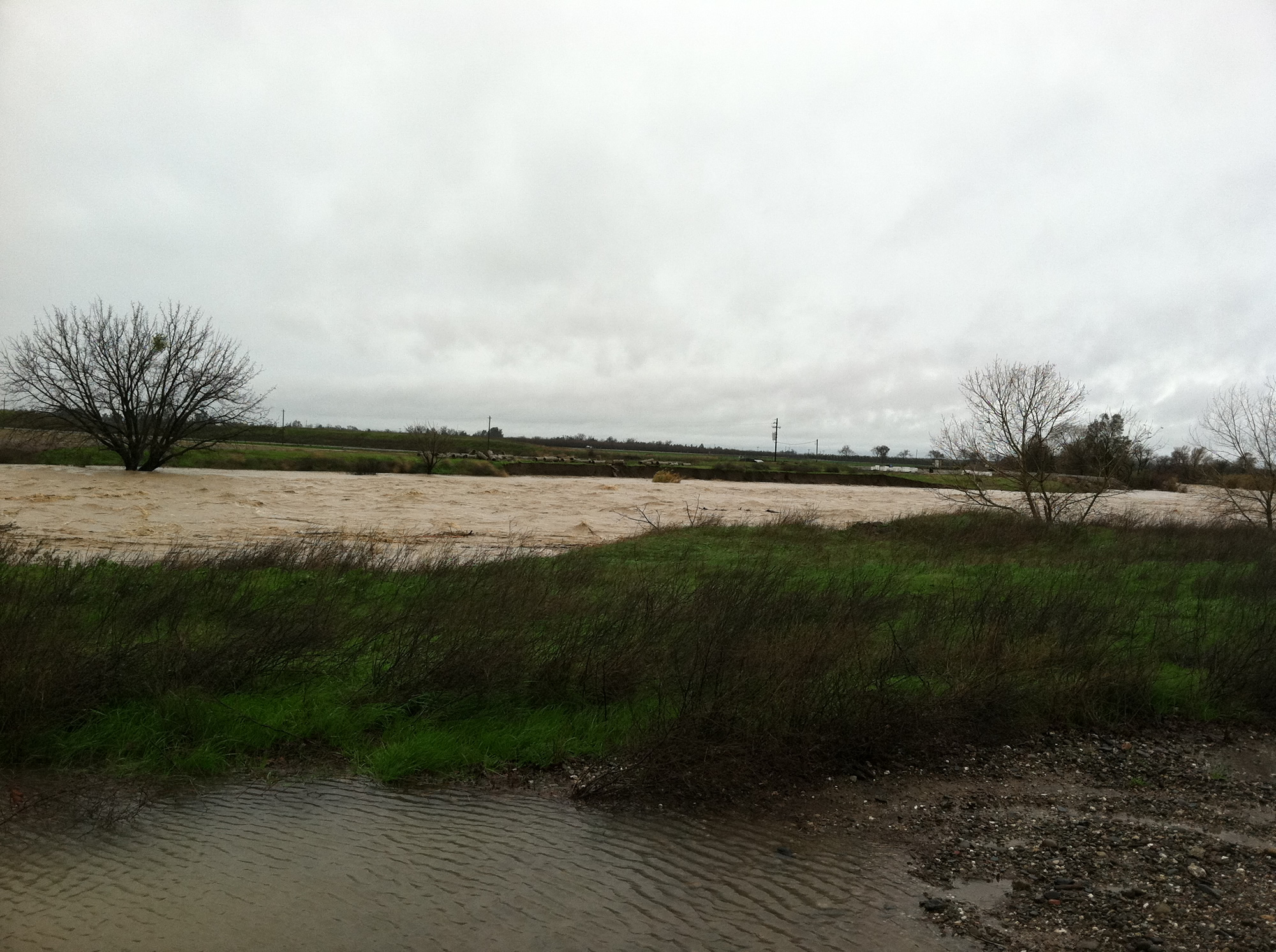
The Elder Creek levee systems are located west of the Sacramento River along Elder Creek near Gerber, California.

At a glance

Part of the Sacramento River and Major and Minor Tributaries Project

West of the Sacramento River

Near Gerber, CA
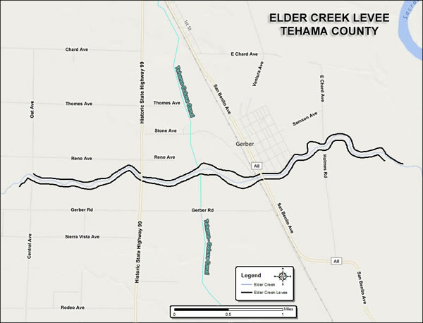
Map of the Elder Creek levee system near Gerber

Elder Creek

Levee System Map

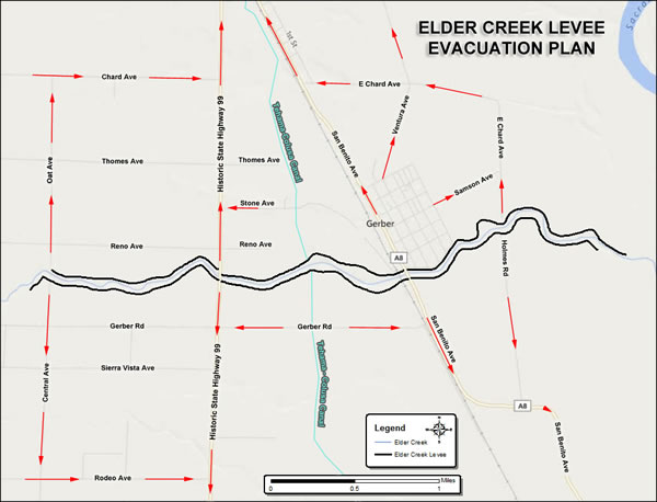
Elder Creek levee evacuation plan map

Elder Creek

Levee Evacuation Map

Private Property

Private Levees

Private levees are to be repaired under the responsibility of private parties. It is not the responsibility of Tehama County to repair private levees.

Please review District Resolution 7-1995 establishing policy for the repair of damaged levee and stream bank protection projects.

What Resolution 7-1995 says

Adopted by the District Board of Directors on August 22, 1995. Summary – see the PDF for the full text.

  1. Routine maintenance: District maintenance and operations resources are committed only to permanently repair and maintain sites mandated by legal agreement with the California Department of Water Resources, U.S. Army Corps of Engineers, or other applicable parties.
  2. Flooding with no emergency declared: where local emergency operations have not been activated and no state or federal disaster has been declared, the District will not provide materials, equipment, or financial commitment to private properties damaged by flood waters. Permanent repairs to private levees and stream courses are the responsibility of the private property owner.
  3. Local emergency operations active: if private levees are damaged and the local Emergency Operations Procedures / Incident Command System has been instituted, District resources may be directed by the Incident Commander to assist in “flood fight” operations only – temporary measures such as materials (sand, sand bags, stakes, etc.), technical assistance and incidental equipment.
  4. State and federal disaster declared: the District may participate in the repair of damaged private levees only if (a) immediate risk to life and multiple properties exists due to a threatened levee, (b) assurance of federal reimbursement funds is provided by an appropriate agency (most notably the Natural Resource Conservation Service Emergency Watershed Program), and (c) indemnification agreement(s) between the affected property owner(s) and the District are executed prior to repair, transferring maintenance responsibilities to the property owner.

DWR Handbook

Flood Fight Methods

The ‘Flood Fighting Methods’ outlined in this booklet have proven effective during many years of use by DWR, United States Army Corps of Engineers, and local agencies on flood-related emergencies. This handbook is published by the DWR Flood Operations Branch and is designed to be used with the Flood Fighting Methods class.
What the handbook covers

  • Levee and embankment threats
  • Patrolling
  • Filling and passing sandbags
  • Sandbag construction
  • Control of overtopping (sack topping, temporary levee)
  • Control of boils
  • Wavewash protection
  • Raincoat method
  • Emergency spillway
  • Structure protection / diversions
  • Water / storm drain protection
  • Flood fight safety
  • Flood fighting terminology
  • Material / equipment list and levee profile

Explore Other Flood Control Pages

More on flood preparedness, floodplain management, flood prevention and county maintained levees.